


The Shoreline Trail is Port Moody’s defining outdoor feature, a 10-kilometre route that traces the north shore of Burrard Inlet from Old Orchard Park at the western boundary of the city to Barnet Marine Park at the eastern end near the Burnaby border. The trail connects the residential waterfront of Old Orchard, the urban hub of Rocky Point Park, the industrial-heritage zone near the CP Rail right-of-way, and the forested slopes above the inlet’s eastern end, all without leaving the water’s edge for more than a few minutes. Few urban trail systems of this length in Metro Vancouver maintain such consistent proximity to the water and such a variety of terrain.
The trail is used by a broad cross-section of Port Moody residents and visitors. Weekday mornings it is primarily dog walkers, joggers, and cyclists. Weekend afternoons in summer it serves families, tourists, and touring cyclists connecting between Burnaby and Coquitlam. The trail’s variety means that different sections draw different users: the paved western section near Rocky Point attracts recreational cyclists and stroller-pushing families; the forested eastern section above the inlet is quieter and better suited to people who want something closer to a wilderness walk.

Trail Overview: Old Orchard to Barnet
The Shoreline Trail’s western terminus is Old Orchard Park, a neighbourhood park on the Burrard Inlet waterfront at the western edge of Port Moody. From here the trail runs east along the inlet, passing close to the water’s edge through a mix of paved path, compacted gravel, and natural surface. The first section from Old Orchard to Rocky Point Park covers roughly three kilometres and is the most urban and accessible part of the route, largely flat and suitable for cyclists, inline skaters, and anyone who wants a waterfront walk without technical terrain.
Rocky Point Park sits at the midpoint of the trail and functions as its central hub. The park’s pier, parking lot, water park, and coffee options make it the logical starting point for visitors who are not doing the full trail. From Rocky Point the trail continues eastward into progressively more forested and elevated terrain. The section between Rocky Point and the eastern end of the city involves some climbing and passes through areas of the Shoreline Trail that feel genuinely removed from the urban context despite being within Port Moody’s boundaries.
The eastern terminus at Barnet Marine Park is accessible from Barnet Highway in the Burnaby-Port Moody border area. The park has a beach on the inlet, picnic facilities, and its own parking area. For those completing the full 10-kilometre trail, Barnet is the endpoint in one direction and the starting point if you are approaching from the Burnaby Mountain trail network that connects from the south and east.
Wildlife: Herons, Seals, and Eagles
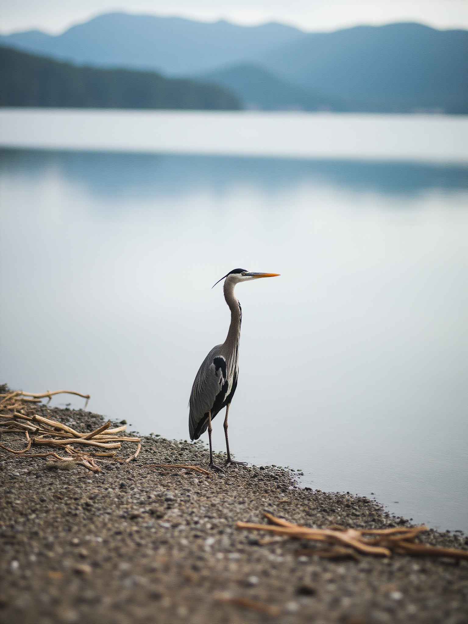
The Shoreline Trail’s proximity to Burrard Inlet makes it one of the better wildlife-watching routes in the Lower Mainland. Great blue herons are the most reliably visible species, standing motionless in the shallows of the inlet at low tide and occasionally visible from the trail at very close range. The herons along this section of the inlet are habituated to human presence and do not flush easily, which allows extended observation from the trail. A heron rookery has been established in the trees above sections of the trail, and the birds are present year-round.
Harbour seals are frequently seen in the inlet along the Shoreline Trail, particularly at high tide when they haul out on logs and rocky outcrops near the water’s edge. The inner portion of Burrard Inlet that the trail follows is sheltered enough that seals are common rather than occasional. From the Rocky Point pier, seals can sometimes be seen surfacing within a few metres. Porpoises are less frequent but do enter the inner inlet, and sightings are more common in the warmer months.
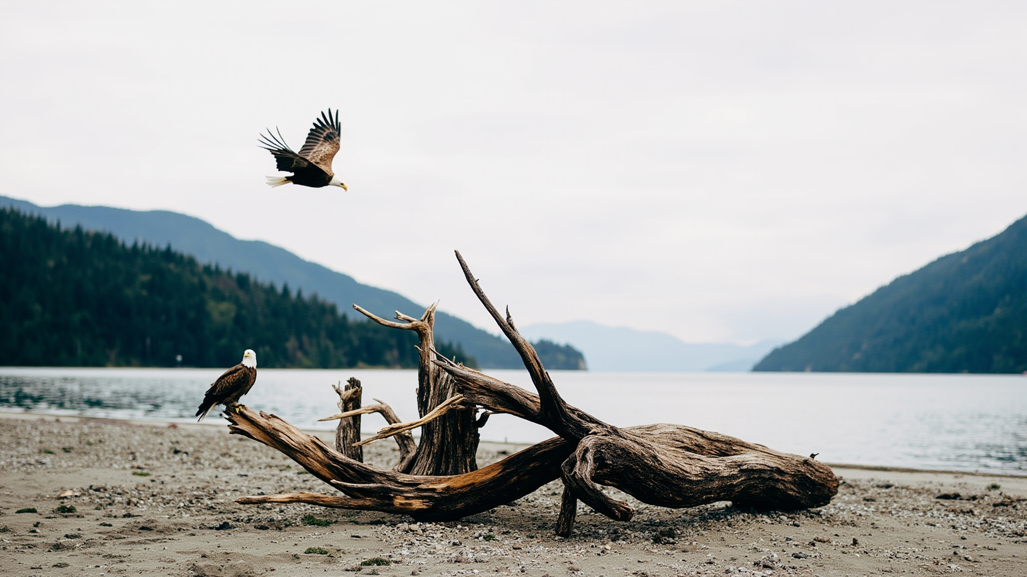
Bald eagles are a regular overhead presence along the entire length of the Shoreline Trail. They nest in the tall Douglas firs above the inlet shore and are frequently seen perched at the tops of dead snags or circling above the water. In winter and early spring, when herring runs bring concentrations of small fish into the inlet, eagle activity along the trail increases noticeably. Other birds commonly seen include belted kingfishers, buffleheads, mergansers, and in summer, Steller’s jays in the forested sections.

Cycling the Shoreline Trail
The Shoreline Trail is partially but not fully suitable for cycling. The western section from Old Orchard Park to Rocky Point is paved and comfortable for most cyclists, including those on road bikes. The middle section through Rocky Point and eastward along the inlet is gravel and compacted surface, manageable for hybrid and mountain bikes but not comfortable for narrow-tyre road bikes. The eastern section toward Barnet Marine Park includes natural surface trail with roots, grades, and sections that require a mountain bike or at minimum a confident hybrid rider.
Cyclists using the Shoreline Trail as part of a longer route between Burnaby and Coquitlam generally treat the Rocky Point to Old Orchard section as the rideable core and detour around the more technical eastern sections. The trail connects informally to the Burnaby Mountain trail system at the eastern end, giving riders access to a much longer network if they are willing to manage the transition on mixed terrain.
The trail is shared with pedestrians throughout its length, and cyclists are expected to yield and call out when passing. The paved western section near Rocky Point can be busy with pedestrians on summer weekends, and riding through this section requires care. Most cyclists treat the Shoreline Trail as one component of a longer route rather than a destination in itself, combining it with the Burnaby Mountain network or the municipal paths through Coquitlam.
Connecting to the Burnaby Mountain Trails
The eastern end of the Shoreline Trail near Barnet Marine Park connects to the Burnaby Mountain trail network, a large system of forested trails on the slopes above Burrard Inlet that includes connections to Simon Fraser University at the mountain’s summit. The connection between the Shoreline Trail and the Burnaby Mountain trails is informal rather than signed, but is well-known to local hikers and cyclists. It turns the Shoreline Trail from an out-and-back route into the starting section of a much larger network.
Burnaby Mountain trails include routes through old-growth forest remnants, viewpoints above the inlet, and connections to the SFU campus trails. Combined with the Shoreline Trail, a full loop from Rocky Point east to Barnet, up onto Burnaby Mountain, and back via the Burnaby side can cover 20 or more kilometres and a significant amount of elevation gain. This is a full-day undertaking for most hikers and requires more planning than a simple Shoreline Trail walk.
The junction area near Barnet is where the Shoreline Trail’s character changes most dramatically. Below the rail corridor and highway the trail is waterfront and relatively open. Above it, the Burnaby Mountain trails enter dense second-growth forest that can feel remote within a few minutes of the trailhead. The transition is abrupt and marks a genuine shift in the kind of experience you are having.
Accessing the Shoreline Trail
The most convenient starting point for most visitors is Rocky Point Park, which sits at the trail’s midpoint and has parking, washrooms, and the option of refreshment before or after the walk. From Rocky Point you can walk in either direction along the inlet, doing an out-and-back of whatever length suits your time and fitness. The full 10 kilometres from Old Orchard to Barnet and back from Rocky Point involves two separate out-and-back sections of roughly five kilometres each.
Transit access to the Shoreline Trail is best via Inlet Centre SkyTrain station on the Millennium Line, which is roughly 1.5 kilometres from Rocky Point Park. The walk from the station to the trail passes through the Murray Street Brewers Row area. Moody Centre SkyTrain station provides access to the western section of the trail and Old Orchard Park end, about 2 kilometres away on foot.
Old Orchard Park has its own parking lot and is a good alternative starting point if Rocky Point is full. The Old Orchard end of the trail is quieter than Rocky Point and gives you the option of walking the most scenic waterfront sections heading east toward Rocky Point without the crowds that gather around the park’s main amenities.
Tips for the Shoreline Trail
Wear trail shoes or hiking shoes rather than road shoes for the eastern sections of the trail. The gravel and natural surface sections between Rocky Point and Barnet Marine Park are uneven and rooted in places, and the grip of a proper trail shoe makes a meaningful difference on wet days.
Bring binoculars if you are interested in wildlife. The great blue heron and bald eagle sightings along the trail are regular but often at a distance that rewards magnification. Low tide is the best time for heron watching; they feed in the exposed shallows.
Do the full trail from Old Orchard to Barnet in a single direction with a vehicle shuttle or a prearranged pickup rather than as an out-and-back. The two ends have different characters and the full linear experience gives you a better sense of the trail’s range than simply doubling back from Rocky Point.
Morning hours are the best time for wildlife and for clear mountain views across the inlet. The peaks above Burnaby Mountain and the distant North Shore mountains are most visible before midday cloud build-up, and the herons are most active in the early morning low tide feeding hours.
Questions Often Asked
How long does it take to walk the full Shoreline Trail?
The full 10-kilometre trail from Old Orchard Park to Barnet Marine Park takes roughly 2.5 to 3.5 hours at a moderate hiking pace without long stops. Allow more time if you plan to spend time at Rocky Point Park, which sits at the midpoint, or if you are doing the route as an out-and-back from a single trailhead.
Is the Shoreline Trail paved throughout?
No. The western section from Old Orchard to Rocky Point is largely paved and suitable for road bikes and strollers. East of Rocky Point the surface transitions to compacted gravel and then natural surface trail. The eastern sections are best suited to trail shoes or hiking boots and mountain bikes rather than road bikes or strollers.
Are dogs allowed on the Shoreline Trail?
Dogs are allowed on the Shoreline Trail and must be on leash in most sections. There are designated off-leash areas along the trail network; signage indicates where these apply. The trail is popular with dog walkers and the surface conditions on the natural sections are comfortable for most dogs.
Can you access the Shoreline Trail by SkyTrain?
Yes. Inlet Centre SkyTrain station on the Millennium Line is approximately 1.5 kilometres from Rocky Point Park, the trail’s central access point. Moody Centre station provides access to the Old Orchard western end. Both walks from the stations to the trailhead are pleasant and pass through the most interesting parts of Port Moody’s street grid.